
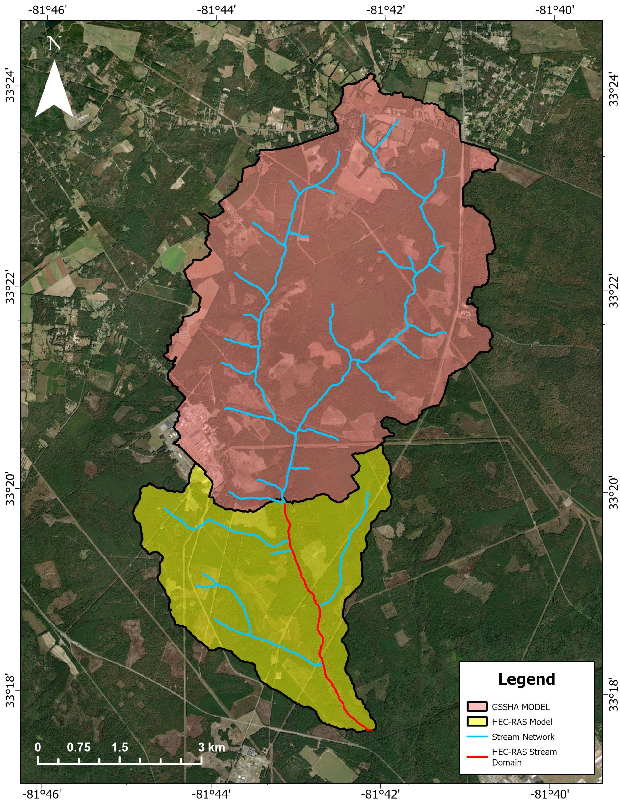
Legacy contaminants can remain stored in riverbanks and floodplains long after their original release. During extreme rainfall, increased flow depths and velocities may erode these deposits. However, erosion does not necessarily result in downstream export because mobilized sediment may remain locally stored or redeposit within the floodplain. Understanding this distinction is important for evaluating contaminant-transport…

Assessing the economic impacts of compound risk at Glynn County
Coastal Georgia is vulnerable to compound risks from coastal inundation and environmental contamination by hazardous materials. These risks are not borne evenly by its population but instead disproportionately threaten underserved communities. Using Glynn County, GA, as a case study, this project proposes to quantify the compound risks of coastal inundation and contamination, and to…

Towards an Operational Compound Flood Model for the St. Johns River
[su_image_carousel source=”media: 1824,1825″ limit=”1″ controls_style=”light” crop=”none” dots=”no” link=”lightbox”] UGA has partnered with the NOAA Southeast River Forecast Center and its chief hydrologist, John Schmidt, to develop a real-time compound flood forecast model for the St. John River watershed in Florida. The project will involve developing state-of-the-art numerical models that could simulate coastal and hydrologic processes…

EPA Region 4 Environmental Justice Thriving Communities Technical Assistance Center
The EPA Region 4 Environmental Justice (EJ) Thriving Communities Technical Assistance Center (TCTAC), housed at RTI International, serves all the states within the EPA Region 4 (Alabama, Florida, Georgia, Kentucky, Mississippi, North Carolina, South Carolina, and Tennessee). UGA is the lead institution in Georgia, and our team includes community-based organizations such as ECO-action and VCI (Vulnerable…

Urban Flood Mitigation using Nature-Based Solutions: the Tietê River in São Paulo City
[su_image_carousel source=”media: 1777,1776″ limit=”2″ controls_style=”light” crop=”none” dots=”no” link=”lightbox”] Major impacts in hydrologic dynamics are expected due to climate change, especially in highly disordered urbanized areas like São Paulo City, which has suffered extreme flood events and water pollution. Similar consequences have been documented in other highly disordered urbanized cities in Latin America, such as Mexico…

Using Hybrid Infrastructure to Reduce Loads on Coastal Features Due to Wave Attenuation
[su_image_carousel source=”media: 1787,1786,1785,1784,1783″ limit=”5″ controls_style=”light” crop=”none” dots=”no” link=”lightbox”] As coastal flooding increases due to global warming, there is a growing imperative for strategies like nature-based solutions (NBS) that use ecosystems to manage floods and erosion. Observations suggest that mangroves, salt marshes, and other living shorelines can protect coastlines during extreme events such as hurricanes and…
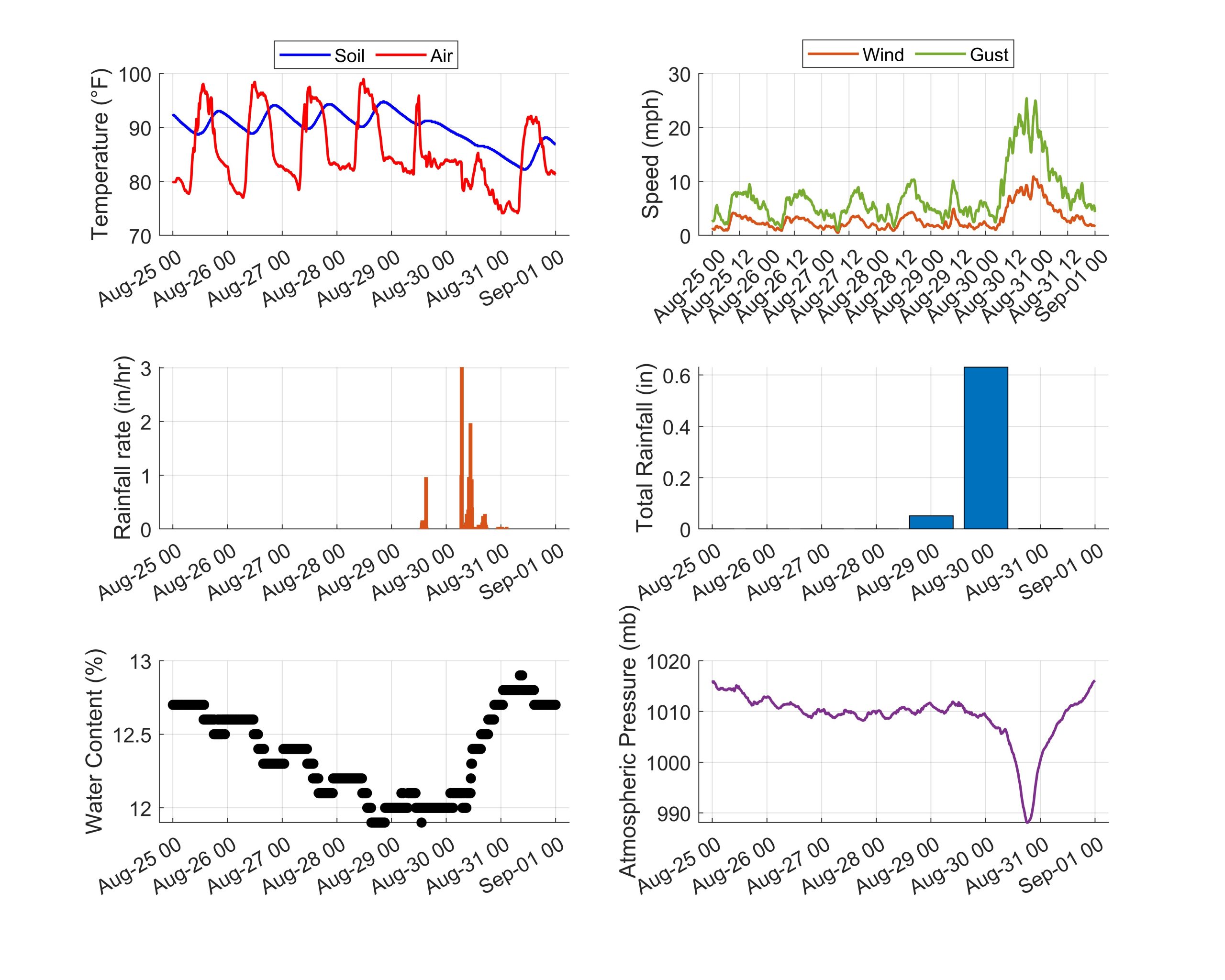
Hurricane Idalia Data
[su_image_carousel source=”media: 1714″ limit=”1″ controls_style=”light” crop=”none” dots=”no” link=”lightbox”] Meteorological data from Hurricane Idalia. For more information about the data being shown, visit https://citra.engr.uga.edu/city-of-tybee-meteorological-station-data

Mapping Compound Inundation along Puerto Rico’s Coastal Watersheds: A Practical Approach
[su_image_carousel source=”media: 1741,1742,1743″ limit=”3″ controls_style=”light” crop=”none” dots=”no” link=”lightbox”] Due to recent compound flood events such as Hurricane Harvey (2017), Hurricane Florence 2018), and Hurricane Sally (2020), inundation studies have transitioned from single flood hazards toward multi-hazard flood modeling approaches. A compound flood is a flooding event that encompasses multiple flood hazards (e.g., precipitation, overland runoff,…
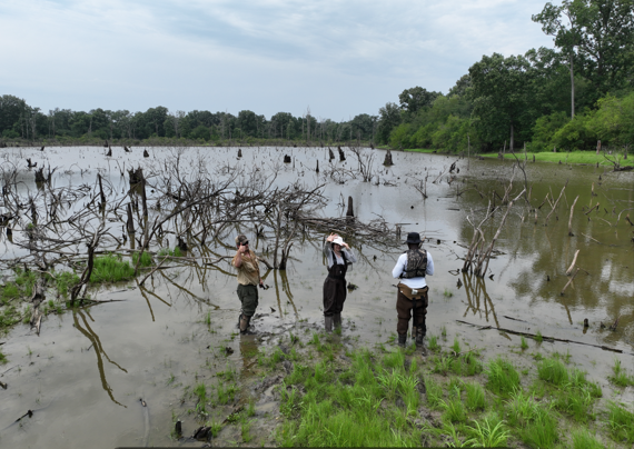
Floodplain Reconnection at Shawnee National Forest Oxbow
[su_image_carousel source=”media: 1738,1737,1736,1735,1734,1740,1739″ limit=”5″ controls_style=”light” crop=”none” dots=”no” link=”lightbox”] The degradation of the Big Muddy River watershed (Illinois, US), resulting from historical agricultural and mining practices and levees, has led to habitat loss and flooding problems in populated regions such as Cape Girardeau. The impact of river channel geometry on flood behavior has been extensively studied,…
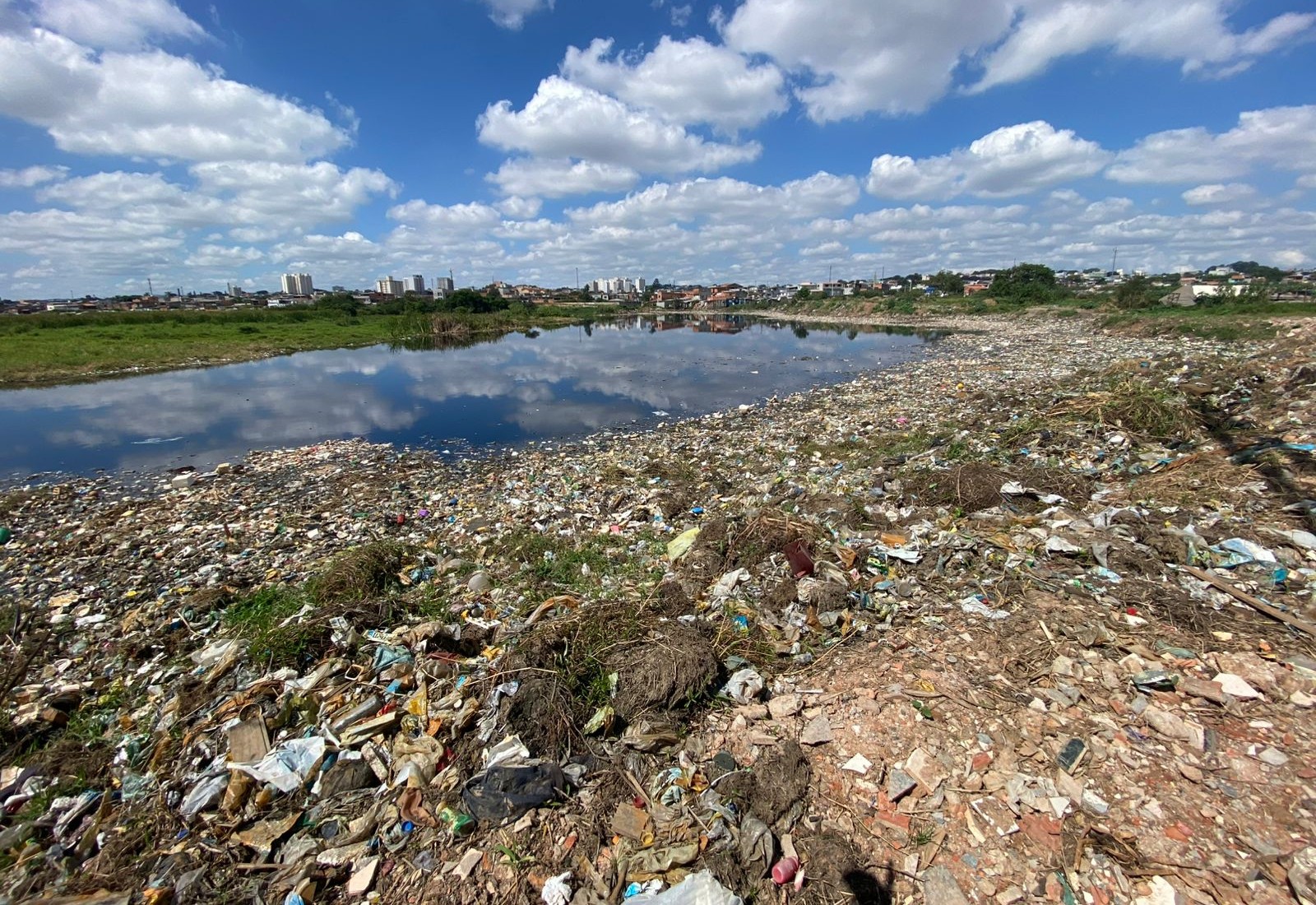
Inland Litter Hydrodynamics: Characterizing the Litter Transport during Wet Weather Events in Communities
During wet-weather events, litter accumulated along streets, gutters, and other urban surfaces can be mobilized by runoff and transported through communities. Along its pathway, litter may remain on the surface, become captured by or block storm-drain inlets, enter the drainage network, or reach rivers and coastal waters. Although plastic transport has been widely studied in…

Impact of Controlled Overtopping on Wetland Rehabilitation and Flood Control
[su_image_carousel source=”media: 1724,1723,1721,1548,1549″ limit=”5″ controls_style=”light” crop=”none” dots=”no” link=”lightbox”] Riverine wetlands along the Mississippi River provide habitats for migratory waterfowl and many other ecosystem services. However, frequent flooding along the Mississippi River caused flood control infrastructure such as levees and dams to be built to minimize flooding impacts. This strategy caused wetland habitat reduction and altered…
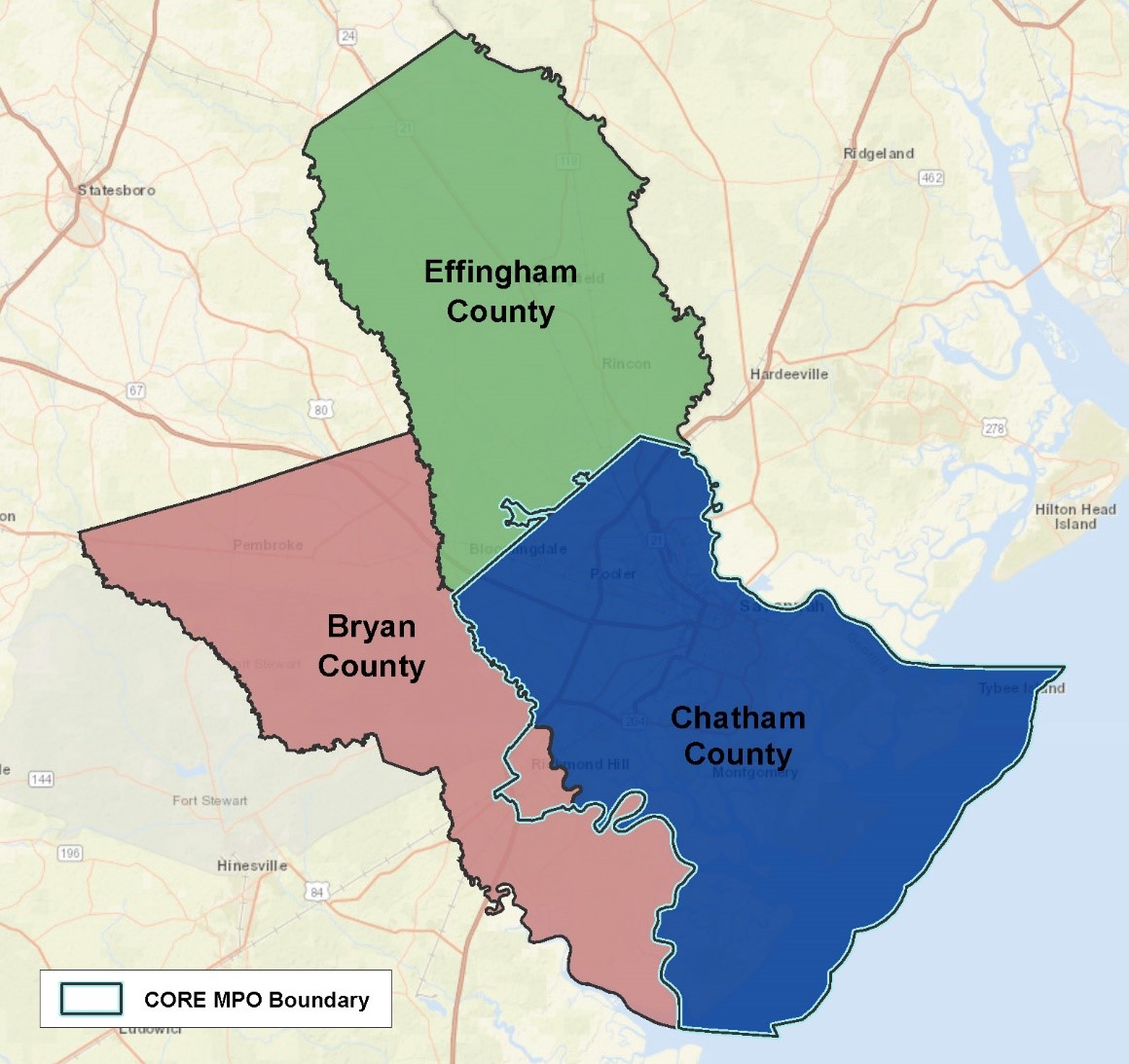
Storm Water Management Model for the Coastal Region of the Metropolitan Planning Organization
[su_image_carousel source=”media: 1544,1543,1545,1546″ controls_style=”light” crop=”none” captions=”yes” dots=”no” link=”lightbox”] The UGA team will review existing plans, tools, and data, including the Roadway Vulnerability Assessment GIS model, to identify additional data for integration into “compound” flooding data that considers: (a) sunny day flooding, (b) storm surge flooding, and (c) select design rainfall events for the CORE MPO…